You wake at 40 degrees in your tent in the middle of Death Valley, stars still visible overhead. No rain fly. You’ve already seen the Milky Way three times this trip just by opening your eyes in the dark. That’s reason one to come to Mahogany Flat Campground. Reason two sits directly above you: Telescope Peak, the highest point in Death Valley at 11,049 feet.
The night before felt like a different planet. The road getting there, Charcoal Kilns Road past the kilns, is rough enough that it clearly filters traffic. You drove a Jeep Rubicon and handled it fine, but the vehicles in the parking lot when you finished told the real story: nothing but Broncos, 4Runners, and Jeeps. That road is not a secret. It’s just a filter. And it works.
Mahogany Flat campground is small, well-maintained, almost never full. Mid-week in May, just you and one other party. No water source, so you pack everything you’re going to drink for camping and the hike. It’s worth the friction.
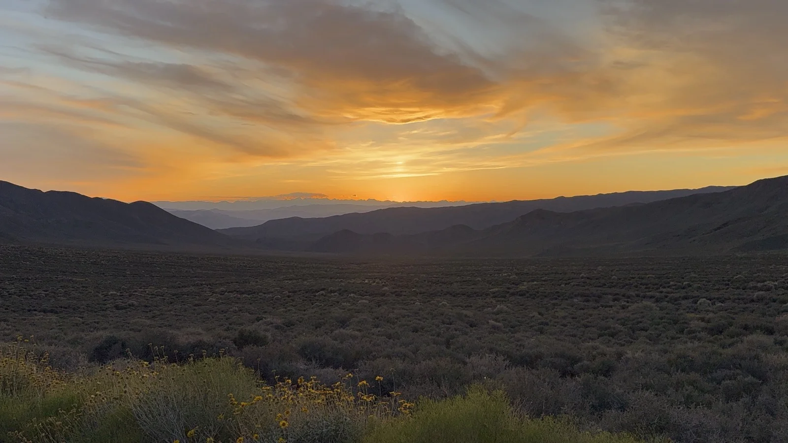
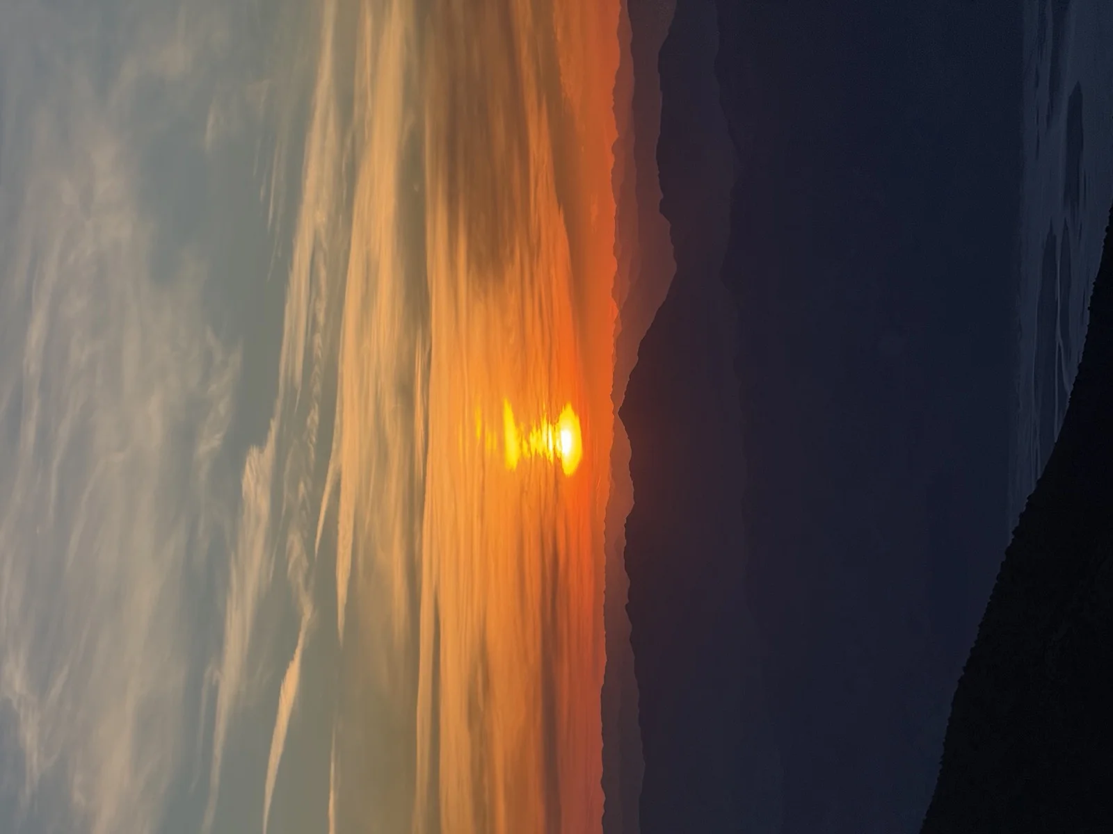
The drive up the backside of the range was a desert sunset masterclass. The colors were showing off. By the time you hit camp, the sky had gone dark enough to see the Milky Way clearly. Every time you woke up in the night, it was still there.
Evening light on the backside of the Panamint Range.
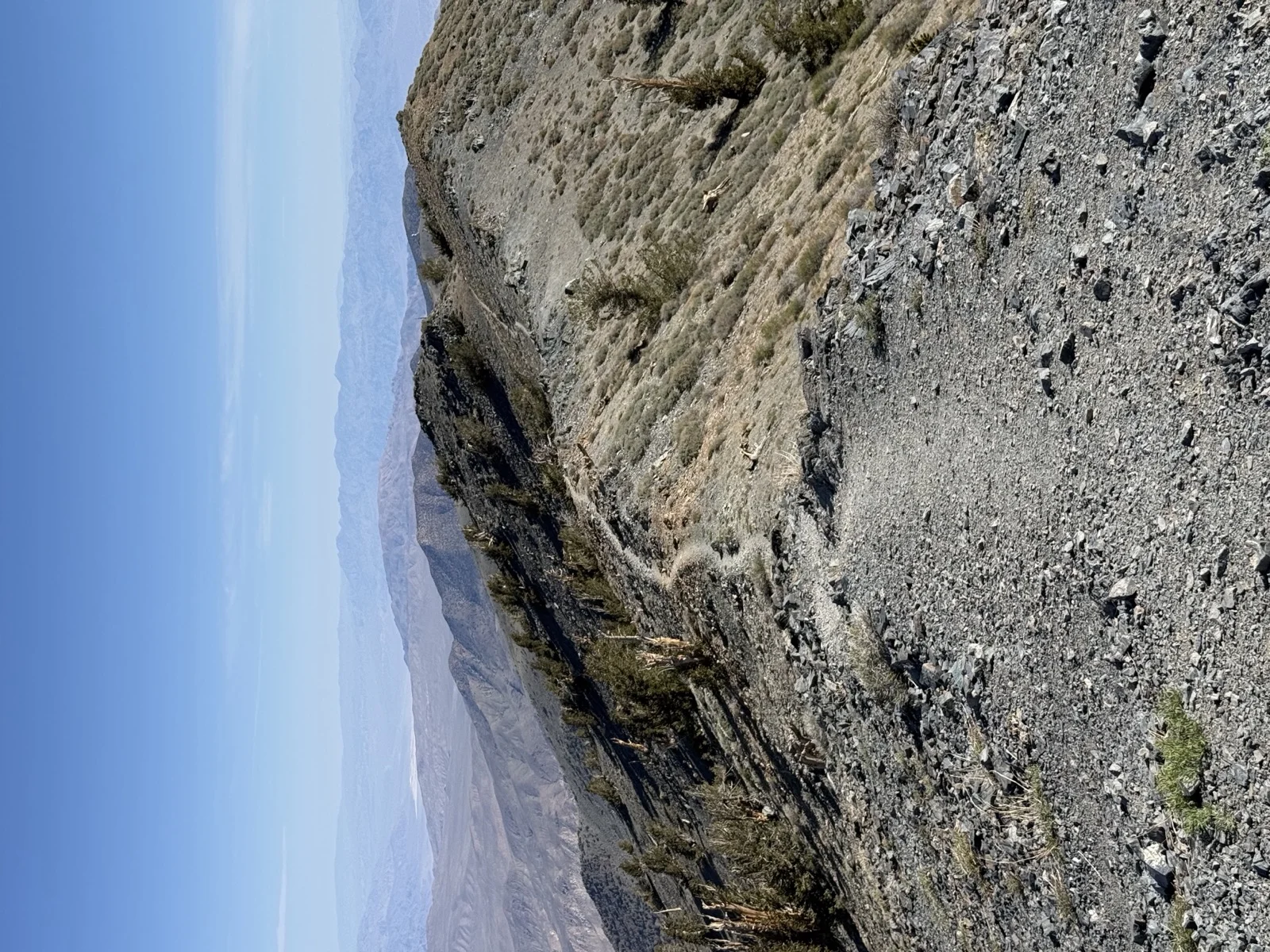
Ridgeline trail with peak visible in distance
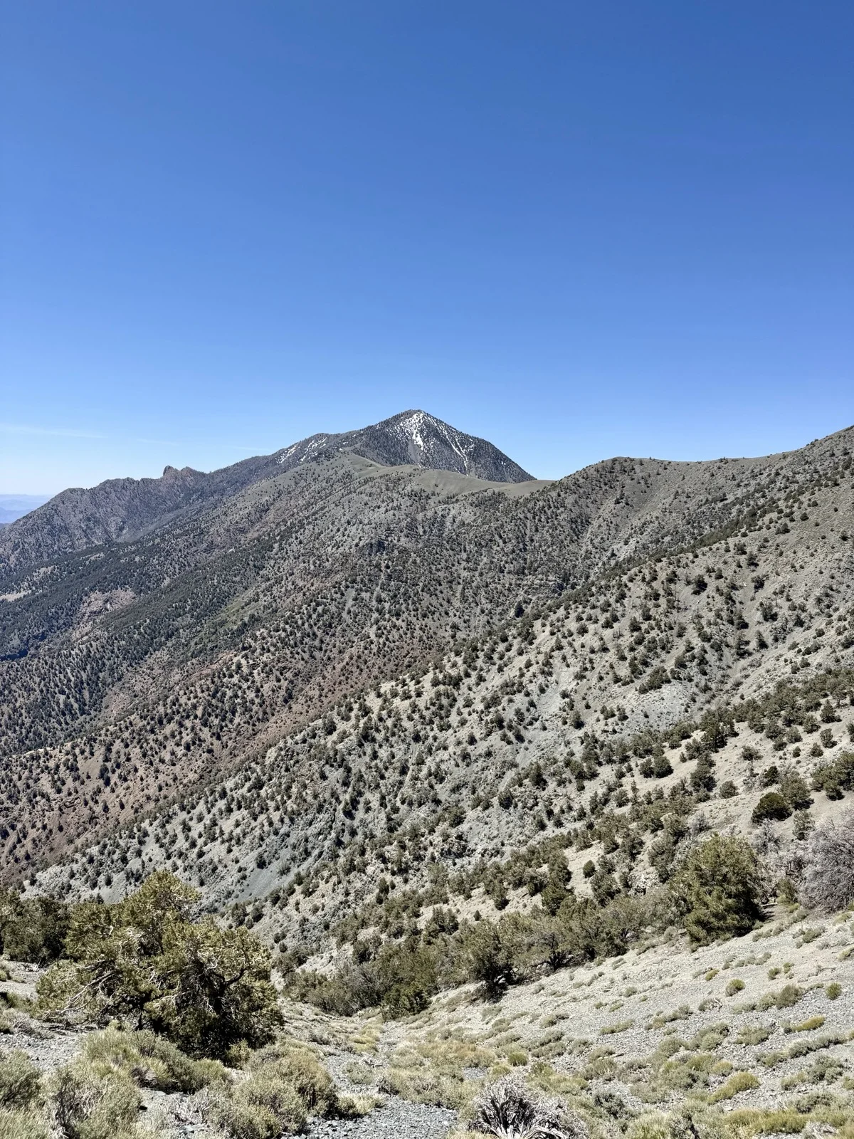
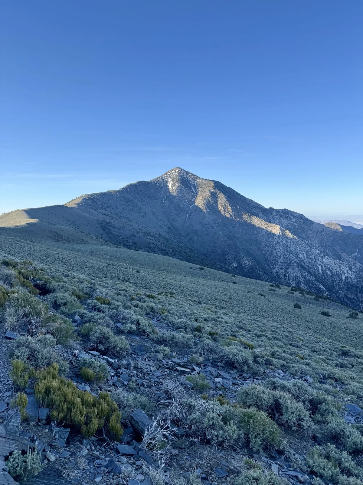
Telescope Peak from the approach trail
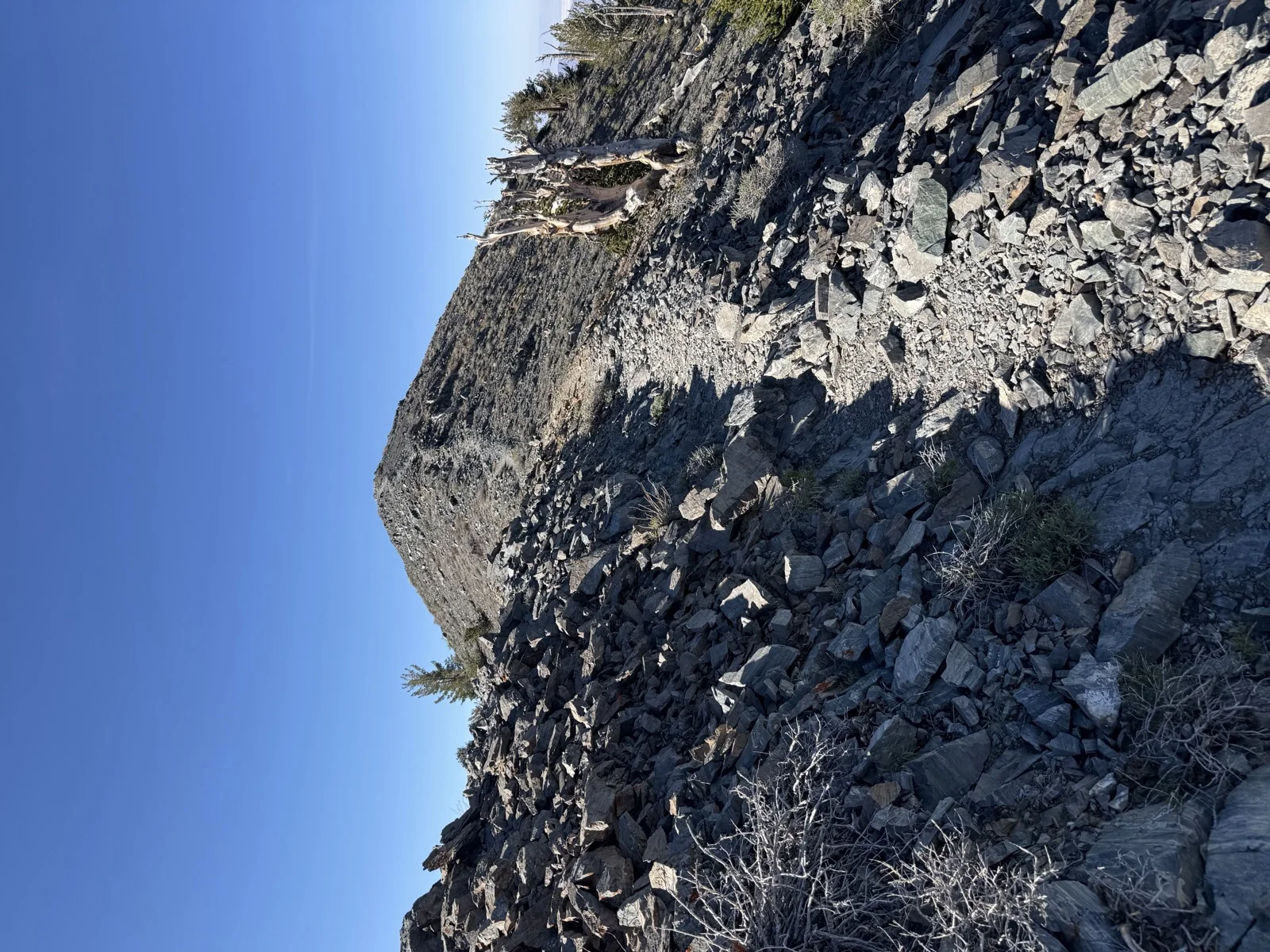
You left the trailhead just before sunrise. The first mile and a half stays in pinyon pine forest, but the ridgeline opens immediately with views down into Badwater Basin. The trail heads south along the ridge for roughly two miles before wrapping around Rogers Peak. This first section is steep: you climb from 7,400 feet at the trailhead to just under 9,000 by mile two. That’s roughly 1,600 vertical feet in what feels like nothing. By mile three, you’re at 9,600 feet, and that’s when the ridge finally opens completely and stays open.
Note on mileage and elevation: Your Garmin recorded 12.6 miles and 3,200 feet of elevation gain. The National Park Service lists the hike as 14 miles round trip with 3,000 feet of elevation gain. The variance reflects different measurement methods and the NPS note that distance figures are “inflated to deter the unprepared.” Your Garmin data is more precise; these notes reflect your actual recorded stats.
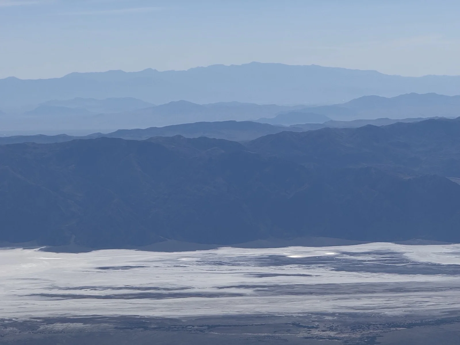
The view from the ridge as sunrise hits is where the hike actually lives. You’re looking straight down 11,000 feet to the white expanse of Badwater Basin salt flats, 282 feet below sea level. The sun comes up behind the Black Mountains to the east, that dark ridge rising up on the far side of the basin. Behind them are more ranges, layers of desert mountains stacked across Nevada. The light hits the Black Mountains first, turns them purple, then pink, then the whole valley lights up. From where you’re standing on the Panamint Range, you can see south into Panamint Valley, west toward the Sierra Nevada, east toward Nevada, and down into Death Valley. The scale is impossible to photograph accurately. This is what you came for.
Badwater Basin and Black Mountains from the summit
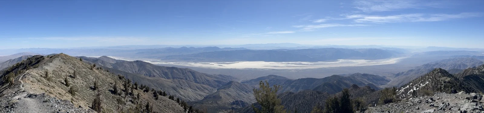
Panoramic view of Death Valley from Telescope Peak
Black Mountains behind Badwater Basin at sunrise from Telescope Peak
From mile three to mile 5.4, the trail flattens. The elevation gain is only about 200 feet, but the terrain rolls enough that you notice the return. This section wraps around the west side of Bennett Peak. There are social trails that might cut a tenth of a mile, but they don’t save elevation. The main trail goes around the peaks instead of over them. The views are nearly identical whether you’re 50 feet left or right. Pick whichever path feels better.
Around mile 5.4, you hit Arcane Meadows. This is where the trail flattens out as you’ve now finished circumventing Rogers Peak, and the trail turns back south. From here the views open west into Panamint Valley for the first time.
After Arcane Meadows, the easy walking ends. You get into switchbacks and the trail steepens. There’s a false summit that reads obvious. A clear peak to the left. Then the real summit is just a couple hundred feet and maybe a tenth of a mile beyond it. The trail registers at the top suggest a handful of people come up here on non-weekend days. It’s quiet. The Mahogany Flat campground is almost never full.
Somewhere around mile four, the first gnarled bristlecone pines start appearing beside the trail on the upper slopes. Their trunks look half-dead and twisted, the kind of trees that seem impossible to age correctly. Some are thousands of years old. Great Basin bristlecones are among the oldest living organisms on Earth. They grow in harsh environments and don’t hurry. You’ll see their weathered, twisted forms scattered across the upper slopes all the way to the summit.
The summit view is why you did this hike. To the east: Badwater Basin, that wide expanse you saw at sunrise now fully lit. To the west: Mount Whitney, the highest point in the lower 48. You’re standing between the lowest and highest points in the continental United States, on opposite sides of you, seeing both clearly. The vertical relief from Telescope Peak down to Badwater is 11,331 feet, higher than the south rim of the Grand Canyon. That’s the geography you’re standing in.
Summit: USGS marker from 1950, metal box with trail registers.
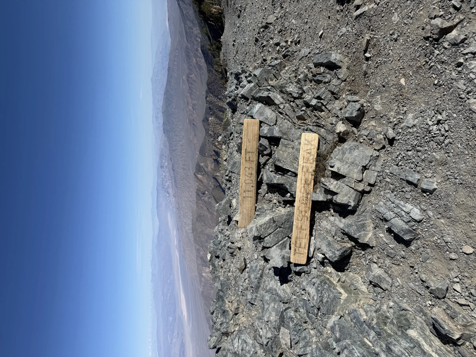
USGS benchmark marker at Telescope Peak summit
Telescope Peak summit
Multiple hikers’ logs stacked in there. People signing in, dating their visits, sometimes leaving notes. It’s a tradition. You had the summit to yourself for about thirty minutes before other hikers arrived. You passed maybe four or five parties on the way up.
Descent: Same trail. Desert sun relentless.
Approaching Telescope Peak from the trail
You’ll be hot by trailhead time, which is why stopping at Panamint Springs for their famous milkshake on the drive out was one of the better decisions of the trip. After a few hours of hiking and trail snacks, a cold milkshake in desert heat hits differently.
One practical note: gas in Death Valley is genuinely expensive. Fill up in Beatty or Lone Pine before heading in if possible. The drive up is worth doing in the evening for the sunset. It gives you the best light and puts you at camp right as it gets dark enough to see the stars. Leave before sunrise if you want the summit to yourself. You probably will.
Related:
The hike is steep on the front end, high altitude the whole way, and you’ll feel the 11,000-foot elevation. But the ridge is straightforward. No scrambling, no navigation puzzles, just walking. The views carry you the rest of the way. On a clear day in May, with Badwater and the Black Mountains to your east and Mount Whitney to your west and ancient bristlecone pines scattered across the upper slopes, that’s all you need.