I’ve climbed Kings Peak four times in the last decade. August 2025 was my most recent summit. The peak hasn’t changed. It’s still 13,528 feet of Utah rock sitting at the center of one of the largest wilderness areas in the lower 48. What changes is you.
The first time, I underestimated the distance. The second, I picked the wrong camp. By the third I understood why people bring four days instead of three. The fourth time, I finally quit fighting the terrain and just moved with it.
Kings Peak is not a technically difficult climb. The scrambling is straightforward. The elevation gain is reasonable. The real challenge is the sheer distance combined with the altitude. You’re covering 27 miles with 4,480 feet of elevation gain while your body adjusts to 13,528 feet. That’s a different animal than a 15-mile day hike.
The Setup
The High Uintas Wilderness sprawls across 475 square miles of alpine terrain between Salt Lake City and the Utah-Wyoming border. Kings Peak sits in the center, the highest point in Utah and one of 57 “ultra-prominent” peaks in the lower 48. It rises at least 5,000 feet above all surrounding terrain. More practically, it’s the tallest peak for 160 miles in any direction.
The standard approach starts at Henrys Fork Trailhead, roughly 140 miles east of Salt Lake City. From the city, take I-80 east toward Park City, exit onto 414 south at the Wyoming bypass, then follow dirt roads. Cell service dies partway in. Download your maps.
The parking lot fills quickly in August, especially weekends. There’s a campground at Henrys Fork if you want an absurdly early start.
Day 1: Trailhead to Camp (8 miles, 2,000 feet gain)
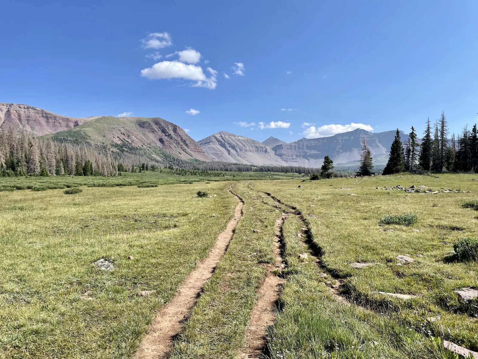
The first 5.3 miles follow the Henrys Fork River gently in forest. You’ll pass the Alligator Lake junction around mile 3.5. Tempting because it’s close and has good campsites. Skip it. You haven’t started the real climb yet.
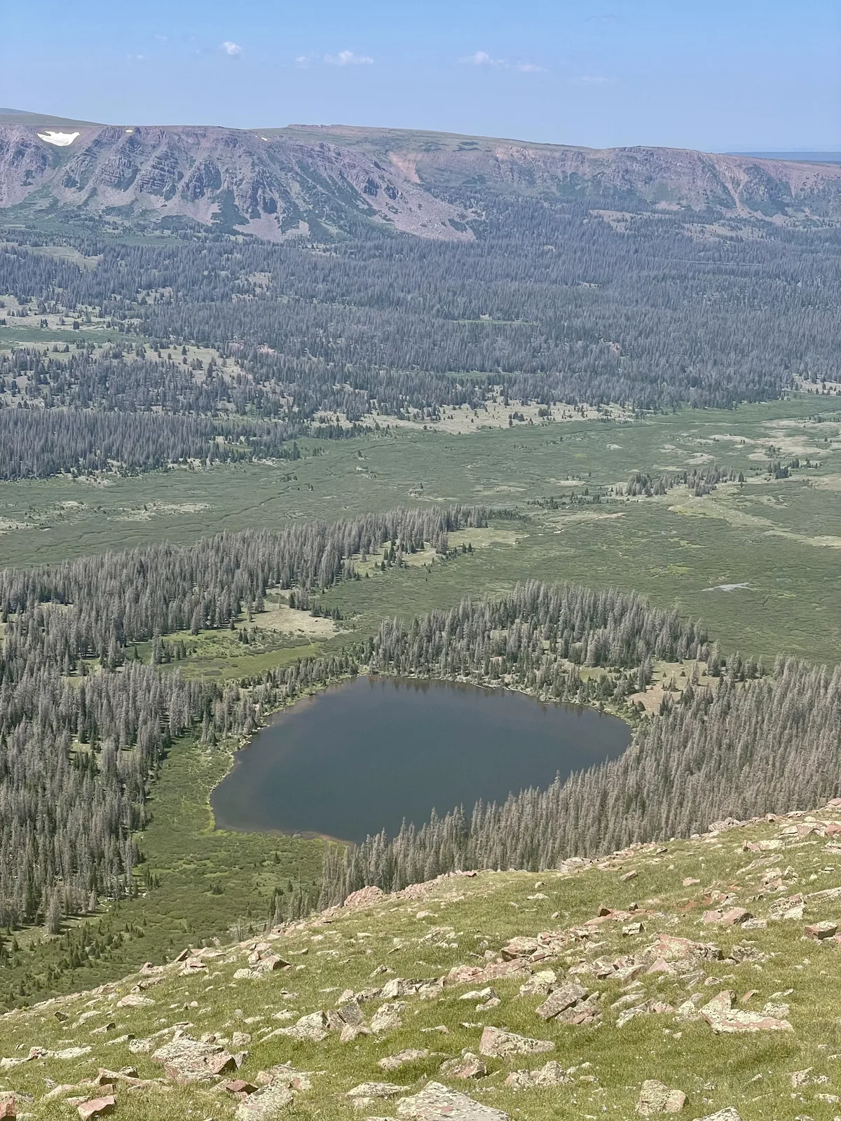
At mile 5.3, you cross Sheep Bridge and leave the forest. The terrain opens into true high country. Two miles of gentle hiking puts you at Dollar Lake, the most popular camp in the basin.
Camp Options: Dollar Lake vs. Yellowstone Creek
You have two distinct overnight itineraries from here. Both work. Both take you to the summit, but from different angles.
Camp Option 1: Dollar Lake (10,200 feet)
Dollar Lake sits on a relatively flat bench with abundant water from two sources. You’re not guessing about water at 2 PM. Established campsites spread hikers out. It’s crowded in August. Expect Boy Scout troops and weekend warriors. But the basin is large enough that you can find quiet ground if you walk past the obvious camping zone.
From Dollar Lake, your summit day is roughly 10.6 to 11 miles roundtrip to the peak and back to camp.
Camp Option 2: Yellowstone Creek (roughly 11,000 feet)
If crowds concern you more than shelter, push past Dollar Lake. The Highline Trail continues northeast toward Yellowstone Creek, passing through increasingly remote country. Water is reliable further up the Highline, and camps are sparse enough that you might actually have the basin to yourself.
From Yellowstone Creek, the approach to Anderson Pass gains roughly 1,600 feet, and the summit day follows a different route than the Dollar Lake option. This itinerary is longer overall but offers genuine solitude.
For this article, I’m describing the faster, more direct Dollar Lake approach I’ve used on three of my four summits.
Day 2: Summit Day (10.6-11 miles to Kings Peak and back to camp)
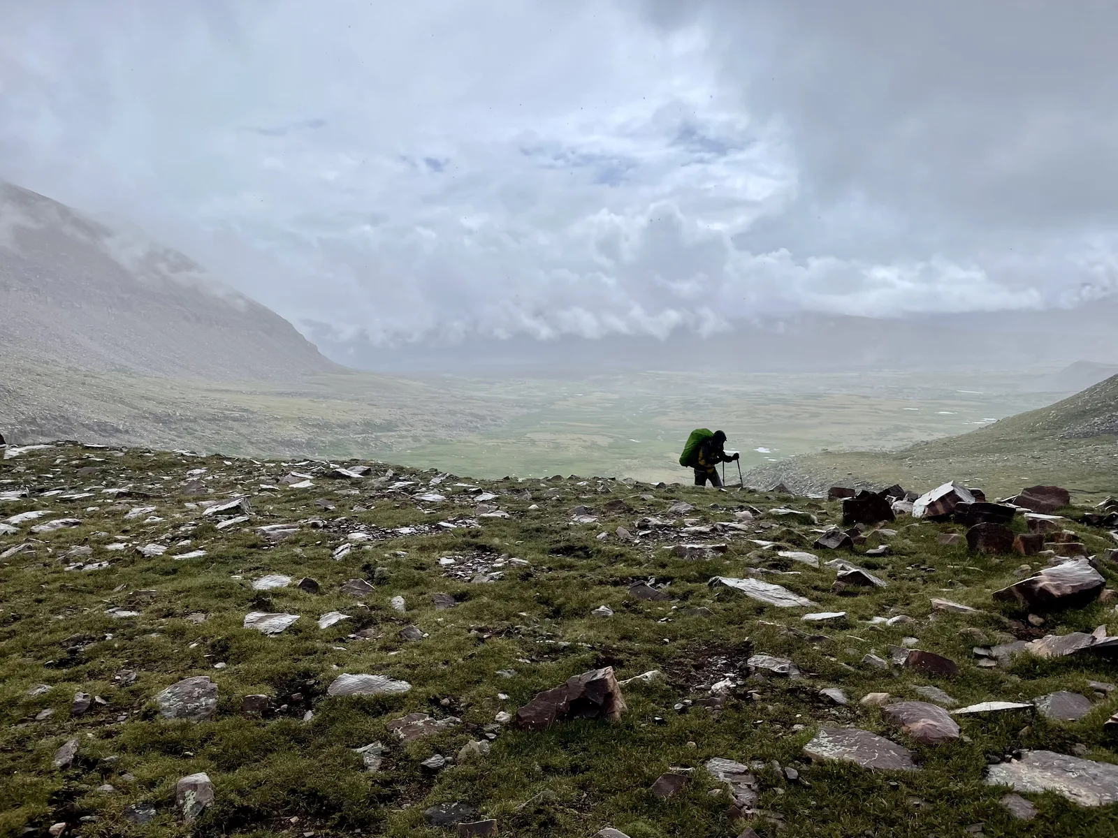
Leave before dawn. The weather window is narrow. Afternoon thunderstorms are common in August, and you’re exposed the entire way back. Summit by 10 AM. Descend off the peak by noon. Be back at Dollar Lake by early afternoon.
From Dollar Lake, the trail climbs 2 miles to Gunsight Pass at 11,400 feet. You’ll gain roughly 1,200 feet to get there. The trail is obvious until the pass itself, where a massive cairn marks the top.
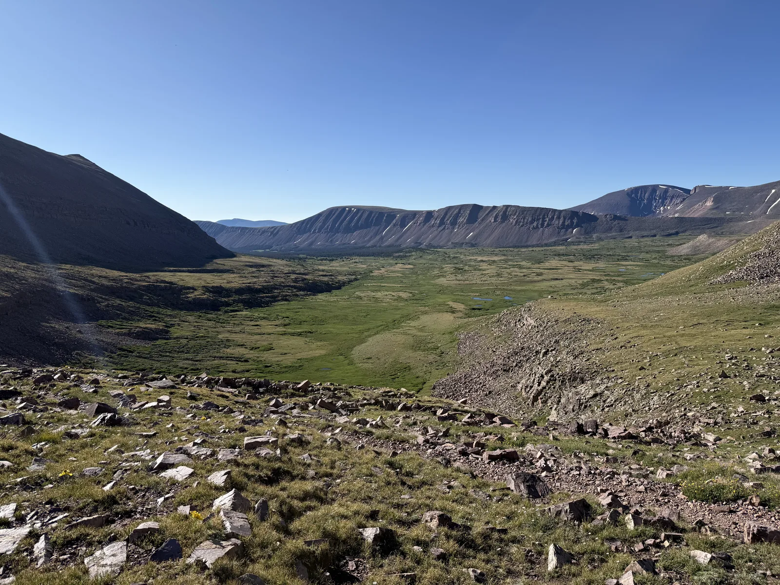
At Gunsight Pass, you face the biggest route decision of the trip.
Option 1 (Trail): Descend into Painters Basin and follow the longer trail around to Anderson Pass. This adds roughly 6 miles compared to the cutoff. It’s longer. It’s safer. Most people do this.
Option 2 (Gunsight Cutoff): Leave the trail and traverse right (south) across loose talus and rocky terrain toward Anderson Pass. This is the shortcut. Saves roughly 4–6 miles but demands comfort with class 2 scrambling, competent routefinding, and acceptance of loose rock. The Gunsight cutoff has become increasingly well-established over the past decade. It was barely a social trail when I first did it in 2015, and now it’s a clear junction with a relatively easy path to follow until you get visual line of sight on Anderson Pass. I’ve taken this route twice. Both times, it was faster and the terrain was stable enough if you move deliberately.
I lean toward the cutoff if you’re confident with navigation and terrain reading. The extra distance adds hours to your day. At altitude, hours matter.
Either way, Anderson Pass is your next waypoint. This is where you leave your pack.
The Final Approach: Anderson Pass to Summit
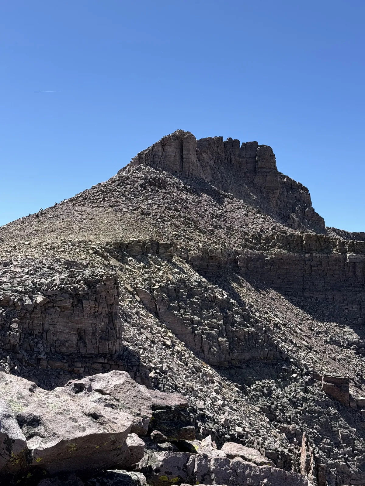
Anderson Pass sits at roughly 12,600 feet. From here to the summit is 0.75 miles and roughly 900 feet of gain, all of it on terrain without an official trail. You’re following trails of least resistance that have been worn in by decades of peakbaggers.
This is where most people go wrong. The social trails multiply as you gain elevation. Many of them lead into cliff bands or tedious scrambling. Stay on the ridgeline. Many of the side trails lead into unnecessary scrambling.
The scrambling gets real in the last 400 feet. Nothing technical. No ropes, no protection. But exposed enough that you’re thinking about your feet. The rock is stable. The exposure is genuine but not dramatic. Class 2 scrambling, straightforward.
Strong hikers reach the summit from Anderson Pass in about 30 minutes. Most parties take closer to an hour.
The Summit and Henrys Fork Basin
Kings Peak’s summit is marked by a sign wedged into the rocks. It’s crowded with names scratched into wood and metal. Get your photo.
But the real reward is the view south into Henrys Fork Basin. This is where the hike justifies itself.
The basin opens up below you in a way that photographs don’t capture. Henrys Fork Lake, Dollar Lake, Bear Lake, and two dozen unnamed alpine lakes scatter across a 15-mile expanse of granite and meadow. The ridgelines around the basin connect visibly. You understand for the first time why this place is special. It’s not the elevation. It’s the architecture of the landscape.
Spend 20 minutes here. Mark your waypoint. Take in the fact that you can see the entire history of your two days below you in one view.
Then get off the peak. Afternoon storms are building.
The Descent and Day 2 Options
Retrace your steps exactly. Anderson Pass, then your chosen route (trail or cutoff) back to Gunsight Pass. Gunsight Pass to Dollar Lake is 2 miles of straightforward hiking if you’re paying attention.
I’ve summited all four of my Kings Peak climbs before noon. Every time, we’ve been off the exposed terrain by 1 PM. Storms rolled in around 2-3 PM. That timing is not negotiable in August.
Option A: Hike Out Same Day
If you start at 5 AM, summit by 10 AM, and descend efficiently, you’re back at Dollar Lake by 3 PM. From there, it’s another 8 miles to the trailhead. You can absolutely drive home that day, especially if you live in the Salt Lake Valley like I did when I did exactly that thing.
Option B: Camp Another Night
Or relax. You’ve earned it. Camp another night at Dollar Lake, enjoy the mountains, and hike out at a reasonable pace the next morning. There’s no rule that says you have to leave on day 2.
If you hike out the same day, Day 2 totals 19 miles.
Route Alternatives
If 27 miles feels like too much, consider the three-day approach: Dollar Lake to camp near Anderson Pass, then a summit push on day 2, then hike out on day 3. Add a day, spread the miles thinner.
Swift Creek Route: 39.5 miles roundtrip, 7,200 feet elevation gain. Starts from Swift Creek Trailhead, follows the Yellowstone Trail north to the Highline Trail, then approaches Anderson Pass from the east. This is longer but more scenic if you have time.
China Meadows Route: 37 miles roundtrip, 6,500 feet elevation gain. Starts from China Meadows Trailhead, passes Lower Red Castle Lake (genuinely stunning), then follows the Highline Trail. Similar mileage and elevation to Swift Creek, just different entry point.
Both alternatives offer solitude you won’t find at Henrys Fork Trailhead. If you want to avoid the parking lot madness and don’t mind the extra mileage, either is worth considering.
Gear and Logistics
Trekking poles matter on this hike. The elevation gain is modest, but the distance is long. Your knees will notice on day 2. Carry two poles.
Water filter: carry a backup. Across 60-plus nights in the Uintas, including twice over the full Highline Trail, I’ve never encountered evidence of bears above 10,000 feet despite what online discussions often suggest. But water filters break. A backup weighs ounces.
Warm layer at altitude. August doesn’t mean it won’t be cold at 13,528 feet. You’re sleeping at 10,200 feet. The weather changes fast.
Headlamp and backup batteries. You might summit late. You might descend in lower light. The trail is obvious, but only if you can see it.
Navigation: map and compass minimum. GPS is fine but batteries die. I prefer a physical map because I know exactly where I am at any moment without depending on electronics. The route is obvious, but being confident matters.
Why This Hike Works
Kings Peak isn’t exclusive. There’s no lottery. There’s no permit office. There’s just a wilderness that’s large enough to absorb everyone, and a peak in the middle that rewards people who move early and respect the distance.
I’ve done this four times in a decade. The first time was about bagging the state’s highest point. By the second, I’d learned to appreciate the vast open terrain. By the fourth, I was there to share the experience with my oldest daughter and show her why the Uintas are one of my favorite places.
If you’re considering it, don’t overthink the difficulty. The scrambling is straightforward. The elevation gain is reasonable. The challenge comes from the 27-mile distance and time spent at altitude. Respect that, move early, and let the landscape do its job.
Trip Details:
- Distance: 27 miles roundtrip (8 miles day 1, 19 miles day 2 including hike-out)
- Elevation Gain: 4,480 feet total
- Best Season: Mid-June through September (August for reliable water)
- Trailhead: Henrys Fork, 140 miles east of Salt Lake City