I started at the Devil’s Lake Trailhead at 34 degrees. Devil’s Lake is the starting point for the South Sister climbers trail, the standard route to the summit. Puffy on, gloves on, moving fast to stay warm. By the time I cleared the forest and the volcano came into full view, the jacket was in the pack. By the summit, I was sweating in a t-shirt. October on a Cascade volcano: bring layers for both seasons.
South Sister is the kind of hike that earns its reputation. Not technical. Not complicated. Just relentless. The upper mountain doesn’t negotiate with you. It goes up at 25% for two and a half miles and doesn’t apologize for it.
The First Two Miles Are Deceptively Easy
The trail out of Devil’s Lake climbs through Douglas fir and sub-alpine forest at a pace that feels manageable. It’s the warmup. You gain about 1,400 feet in those first two miles, but the tree cover keeps the sun off and the grade is consistent enough to find a rhythm.
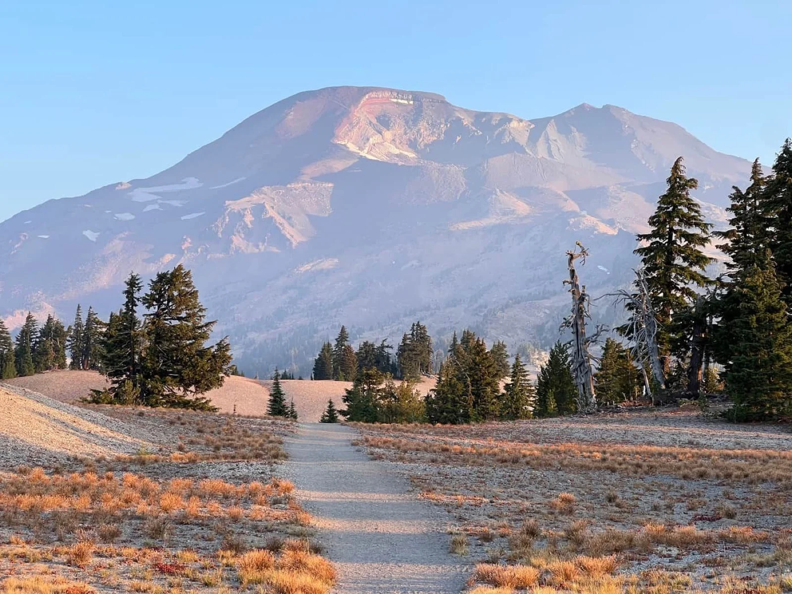
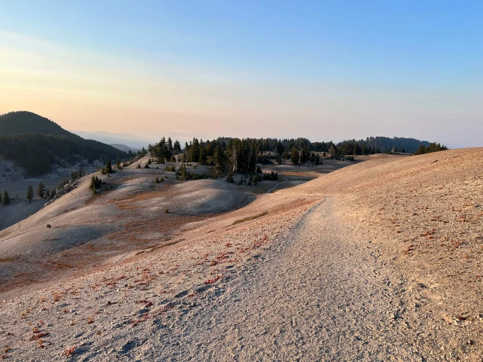
When the forest breaks and you hit the open sandy plateau, everything changes. Broken Top appears to the east, sharp and fractured against the sky. South Sister is right in front of you. The scale of what’s left becomes obvious. Most people slow down here, not because they’re tired, but because they’re recalibrating.
This is the best photography section of the hike. The plateau stretches out flat and pale against the dark volcanic cone behind it. Take the photo. You’ll want it.
Moraine Lake and the Real Climb
Moraine Lake appears to the east around mile 3.2. Broken Top frames the view behind it. It’s a natural basecamp for overnight hikers and the junction point if you came up from Green Lakes instead. From here, the trail pitches up and stays pitched.
What most people don’t know: the grade doesn’t vary much. There are no switchbacks on South Sister. The South Sister trail goes straight at the mountain for the last 2.5 miles. If you’re used to trails that zigzag to manage elevation, this will feel unusual. It’s not harder because of it — it’s just more direct than most people expect.
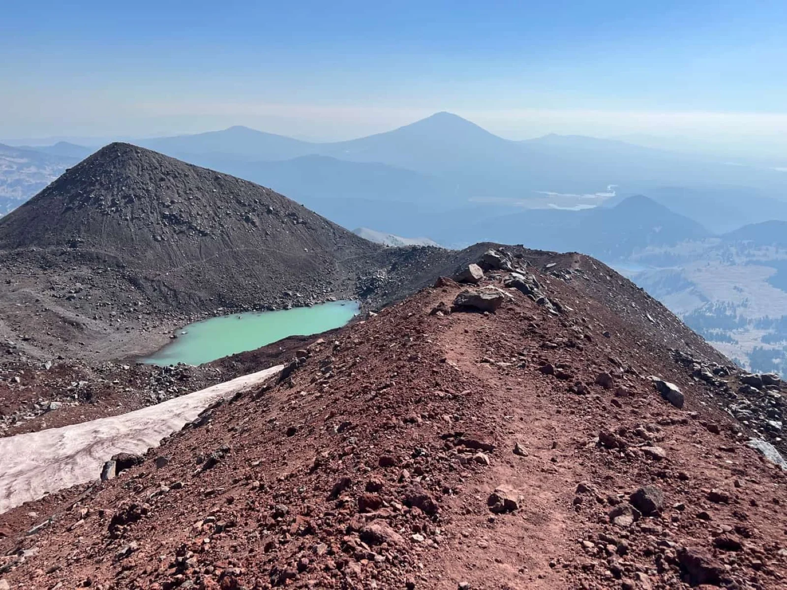
Lewis Glacier: Check Yourself Here
At about mile 4.7, Lewis Glacier comes into view. The tarn just below it is the most reliable water source on the route. Fill up if you need to. More importantly, stop and think for a minute.
The summit is 1.3 miles away. It looks close. It’s not close in terms of effort — it’s another 1,500 feet at the same grade you just came up. Check your energy, check the weather, check your water. If it’s past noon and you’re not feeling strong, Lewis Glacier is a respectable turnaround. The views back to the south are excellent from here, and the summit will be there next season.
I kept going. October 9th, the weather was perfect: clear sky, light wind, no sign of anything changing. There was no reason to stop.
The Summit
The upper section above Lewis Glacier is loose and steep. Nothing technical, but the footing requires attention. Slow down before you think you need to. The volcanic scree moves underfoot and a twisted ankle up here is a long way from the trailhead.
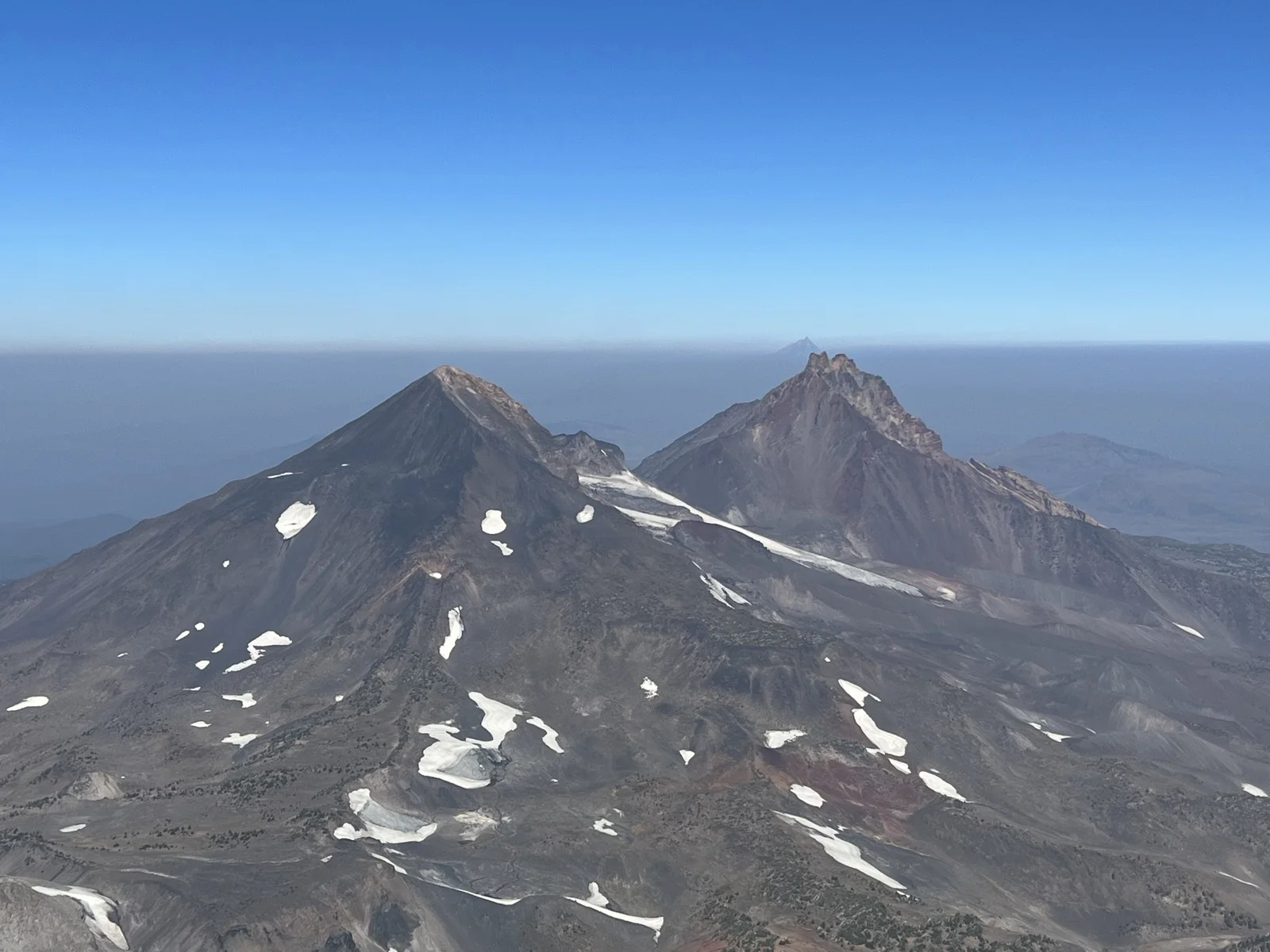
The crater rim opens up all at once. You’re on top of Oregon’s third tallest peak at 10,363 feet, and the views confirm it. North and South from the summit: Mount Hood, Mount Jefferson, Three Fingered Jack. Broken Top is directly to the east and closer than it looks from the trail below.
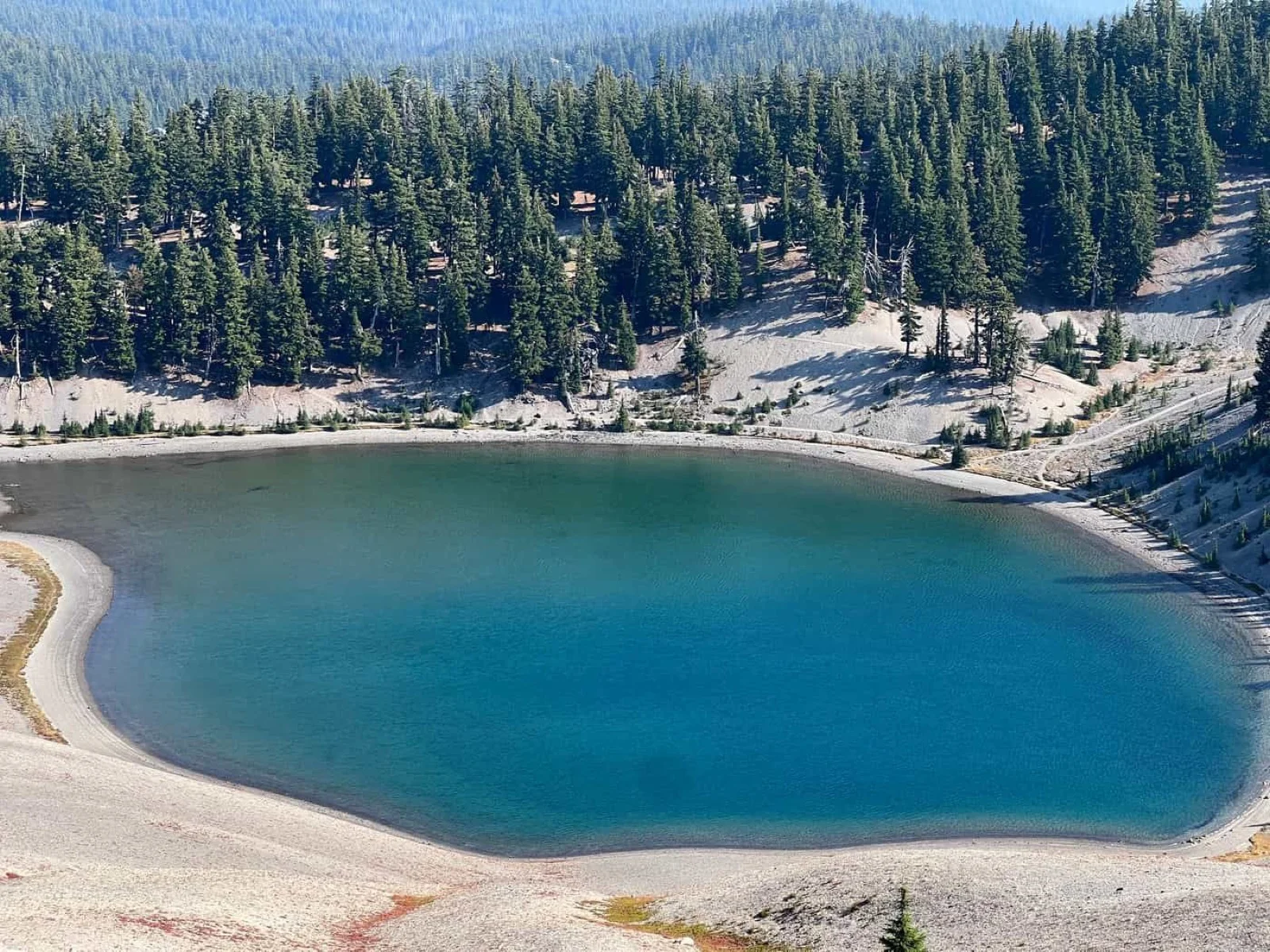
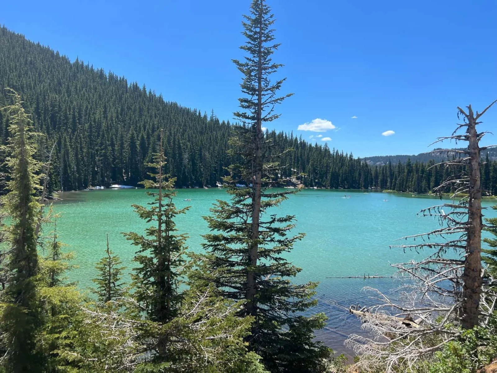
Teardrop Lake sits in the crater below, the highest lake in Oregon.
The day I was up there, there was some smoke in the distance to the south. Long-range views weren’t perfect. But Middle Sister and North Sister were sharp and close, the Three Sisters Wilderness lakes spread out below, and the sky above the summit was completely clear. I’ll take that.
The crater rim loop is about a mile. It’s worth doing if you have the legs for it. Loose rock throughout, but it’s well-traveled enough that the route is obvious.
The Descent
This is where the trekking poles earn every penny. The upper section coming down is steep, loose, and relentless in the same way it was going up — except now your knees are handling the impact instead of your lungs handling the grade. Poles take a significant amount of stress off your joints on the way down.
I came off the summit at a deliberate pace. The sandy sections above Moraine Lake are deceptive — they look soft and forgiving but will catch your feet if you move too fast. Take your time until you’re back in the trees.
By the time I hit the trailhead, the temperature had climbed to the mid-60s and I was back to a t-shirt. Devil’s Lake was right there. On a warmer day I would have gone in. If you’re making a weekend of it, Devil’s Lake Campground is right at the trailhead, a reasonable basecamp if you want an early start without a long drive in the dark.
A Few Practical Notes
October is an excellent month to hike South Sister if the permit window is still open. The crowds thin out significantly compared to July and August. The trail was quiet on my day — I passed maybe 30 people total, which for a 12-mile out-and-back on a popular Cascade volcano is practically nothing.
Permits are required from mid-June through mid-October for day use at the trailheads accessing South Sisters and the broader Three Sisters Wilderness. They’re managed as part of the Central Oregon Central Cascades Wilderness Permits program and open on a rolling ten-day window at recreation.gov. Search “South Sister” or browse under Cascade Lakes. The Forest Service updates availability daily. If you’re planning to hike South Sister this fall, set a calendar reminder and check ten days out from your target date. The permits are there if you look at the right time.
Start early regardless of season. The drive in on Cascade Lakes Highway from Bend is straightforward, roughly 30 minutes past Mount Bachelor to the trailhead. The upper mountain gets hot in full sun, and afternoon thunderstorms — while not common in October — aren’t impossible in the Cascades.