Nevada’s tallest peak is Boundary Peak at 13,140 feet, right along the California border in the White Mountains. If you descend from Boundary’s summit to the saddle and walk less than three-quarters of a mile to neighboring Montgomery Peak at 13,441 feet, you’re looking down on the state high point. Boundary Peak is a technicality.
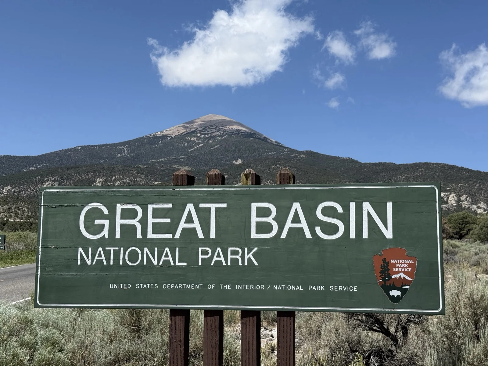
Wheeler Peak is the mountain that feels like Nevada’s high point. At 13,065 feet in Great Basin National Park, you’d have to travel over 230 miles in any direction to find something taller. It’s also the 12th most prominent peak in the lower 48, with 7,568 feet of prominence. That qualifies it as an Ultra Prominent Peak, a designation shared by only 57 summits in the contiguous United States.
I’ve summited Wheeler Peak four times over nine years. Solo in August 2016, with a friend in August 2017, with another friend in August 2023, and most recently with my youngest daughter in June 2025. The first time, I was just chasing a summit. By the fourth, I was showing my kid why this corner of Nevada is worth the drive. The route never gets old. The mountain earns more respect every time.
At a Glance
| Detail | Info |
|---|---|
| Summit Elevation | 13,065 ft |
| Round Trip Distance | 8.5 miles |
| Elevation Gain | 3,100 ft |
| Average Grade | 14% |
| Route Type | Out and back |
| Class | Class 1 |
| Exposure | Low (moderate wind above treeline) |
| Permit Required | None |
| Trailhead | Wheeler Peak Summit Trailhead, Great Basin National Park |
| Season | Mid-June through late September |
| Average Time | 4-6 hours round trip |
| Trailhead Parking | 19 spaces (fills on summer weekends) |
Getting There
Great Basin National Park is remote in a way that most national parks aren’t. The nearest town is Baker, Nevada, which has fuel and a taco truck. If you need lodging or a real meal, that’s Ely, Nevada, or Delta, Utah. Plan accordingly. Pack food for a few days and secure a campsite.
Here’s a surprising fact: Great Basin National Park is actually closer to Salt Lake City by drive time than any of Utah’s five national parks. The drive in is worth it on its own. US-50, famously dubbed America’s Loneliest Highway, is the primary gateway from the north. From Las Vegas, it’s about 4.5 hours via US-93 through some of the emptiest country in the lower 48.
When you enter the park, you’ll hit an early junction. Continuing straight takes you to the Lehman Caves Visitor Center. Bearing right puts you on the Wheeler Peak Scenic Drive.
Wheeler Peak Scenic Drive
The scenic drive climbs over 3,600 vertical feet from the park entrance to the trailhead. Stop at Mather Overlook on the way up for the best views of the surrounding desert and Snake Range. Mather is also one of the better spots in the park for night sky photography if you’re willing to drive back up after dark.
The Route: Trailhead to Summit
Trailhead to Stella Lake Junction (1.1 miles, 160 ft gain)
The Wheeler Peak Summit Trailhead sits at the end of the scenic drive, roughly 11 miles from the start of the road. The parking area has 19 spaces and fills on summer weekends. Start early.
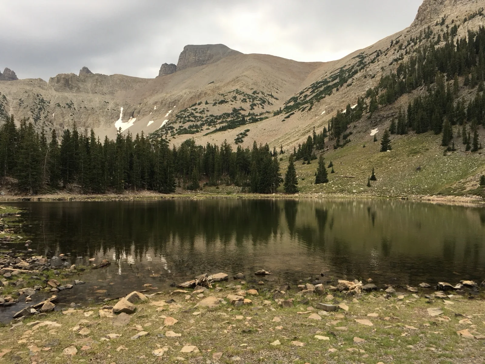
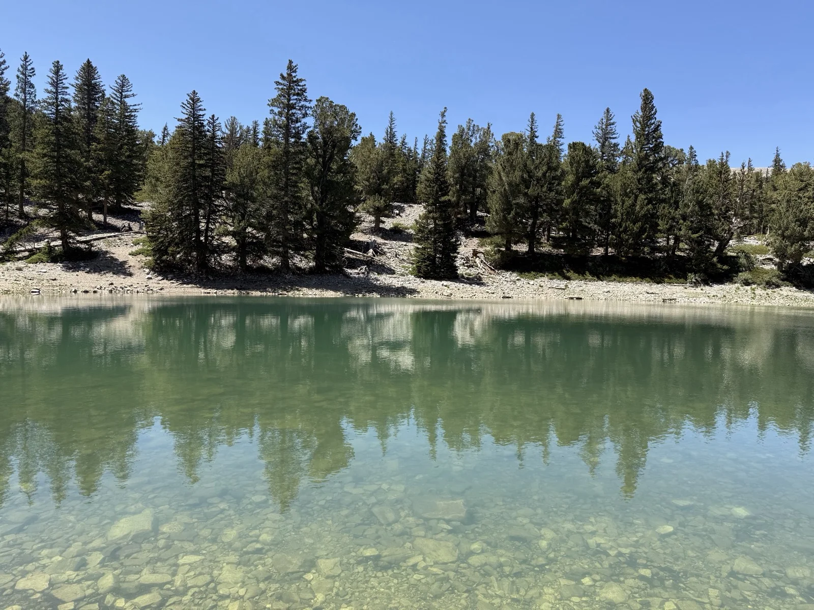
The trail begins gently through subalpine forest with minimal incline. At about 1.1 miles, you hit the junction for Stella Lake. The lake is worth a visit, but it’s better as a stop on the way back down. On my overnight trips, I stopped at Stella for a snack on the descent and sat in the sun for a while. Early in the hike, you don’t need the break yet.
Water note: Stella Lake is essentially the only water source on this route, and it’s so close to the trailhead that it’s not worth planning around. This is a bring-everything route. Two to three liters minimum, more if it’s hot or you’re coming from lower elevation.
Stella Lake to the Saddle (1.2 miles, 420 ft gain)
After the junction, the trail works toward a broad saddle where the tree line ends. The quartz-covered ridgeline and the peak come into clear view ahead. This is the transition point. You leave the forest behind and everything above is exposed to wind and weather. On my 2017 trip, we hit steady 30-mph gusts from the saddle onward. On the June 2025 trip with my daughter, it was dead calm. Same mountain, different days.
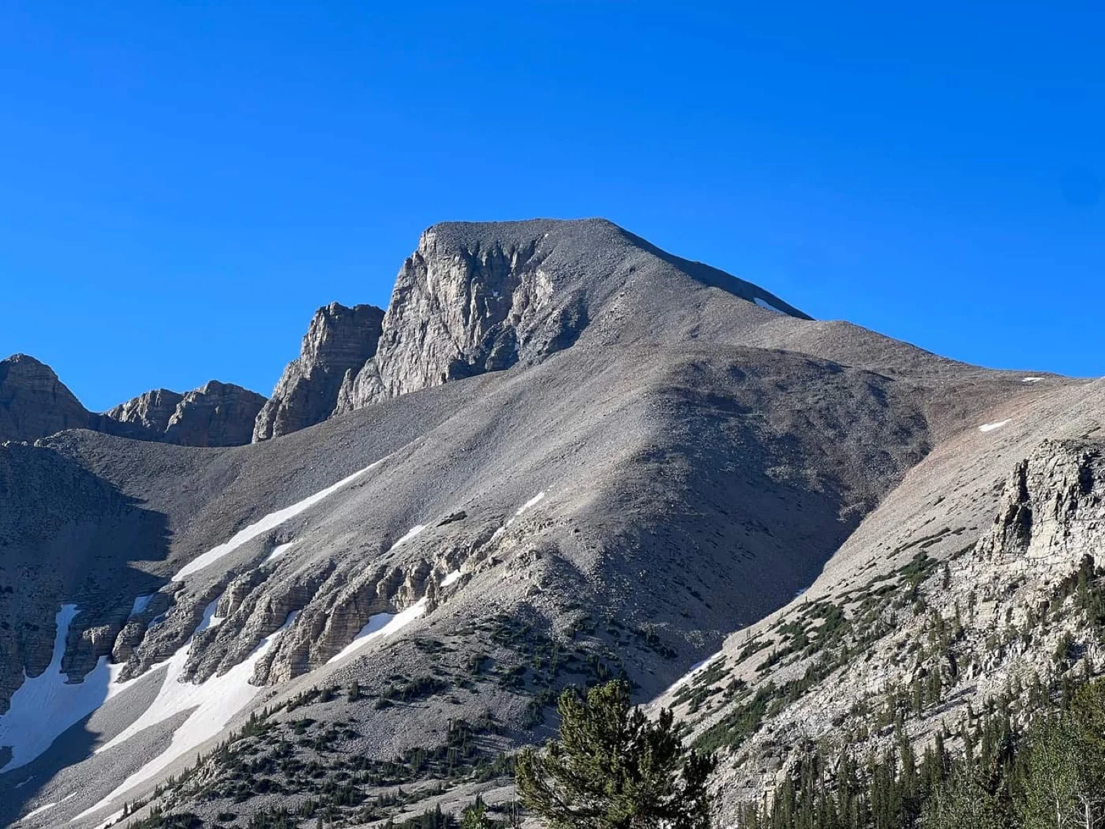
The Saddle to the Summit (1.9 miles, 2,080 ft gain to 13,065 ft)
Now the real climbing starts. The trail steepens continuously from the saddle to the top. The last half mile alone gains over 900 feet. If you started your day at lower elevation and haven’t acclimated, you’ll feel the thin air at 12,000 feet. By 13,000, every step costs more than you expect.
The summit delivers.
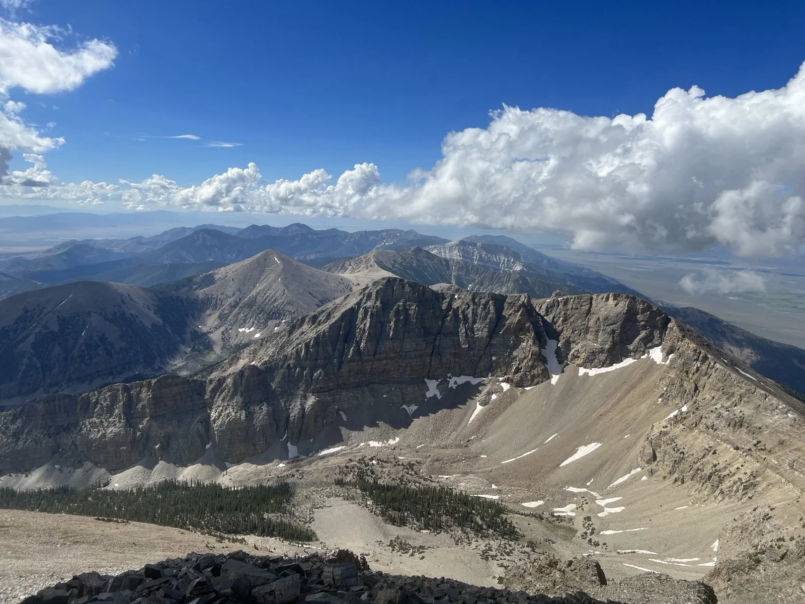
Looking east, you can follow the ridge of the Snake Range to Jeff Davis Peak. A few people have traversed that ridge, but it’s exposed and filled with loose rock. Not casual. Looking north, the saddle you just climbed and the open ridge to Bald Mountain. To the south, Baker Peak and further out, Mount Washington. Directly below the summit sits the Wheeler Peak rock glacier, often cited as Nevada’s only glacier, though its classification gets debated among glaciologists and peakbaggers alike.
Some people find the desert monotonous. I find the scale of it, the sheer emptiness and distance, to be one of the more compelling summit views in the West. On my 2016 solo trip, I sat on top for over an hour because nobody else was there and there was no reason to leave. By my fourth time up, with my daughter, I spent less time looking at the view and more time watching her take it in for the first time.
Coming Back Down
Weather moves in fast at this elevation. The Great Basin floor sits over 8,000 feet below the summit, and that temperature differential creates afternoon storms that build quickly. If clouds are forming, don’t linger. The exposed section on descent isn’t long for a 13,000-foot peak, and treeline is relatively close.
Trekking poles earn their weight on the way down, especially the first mile off the summit where the grade is steepest. Your knees will thank you.
Side Trip: The Alpine Lakes Loop
For hikers looking to extend the day or skip the summit entirely, the Alpine Lakes Loop passes Stella Lake, Teresa Lake, and connects to views of the bristlecone pine grove and the base of the Wheeler Peak rock glacier. The loop adds miles but stays in the forest for much of the route. It’s a legitimate day hike on its own and a good option if weather pushes you off the summit route.
The bristlecone pines here are over 5,000 years old. Some of the oldest living organisms on the planet, growing in one of the least visited national parks in the country.
Camping in the Park
Wheeler Peak Campground
Wheeler Peak Campground sits near the top of the scenic drive at 9,886 feet, first-come-first-served, and fills on summer weekends. Get there early or grab a site midweek.
I camped here on my 2016 solo trip, and it was one of the best campground experiences I’ve had in a national park. The elevation puts you in dense mountain forest that feels nothing like the desert you drove through to get there. The sites are well-spaced. It’s quiet. And at nearly 10,000 feet, you’re already acclimated for an early start on the summit the next morning. If this campground has spots, take them. Don’t look anywhere else first.
Baker Creek Campground
Baker Creek Campground sits at about 7,530 feet down a gravel road, roughly 3 miles from the Lehman Caves Visitor Center. Also first-come-first-served, with 37 sites along Baker Creek. Lower, warmer, and more accessible than Wheeler Peak Campground. I stayed here on my 2023 trip. It’s a fine base camp, but it adds 2,300 feet of elevation you haven’t acclimated to if you’re heading for the summit early the next morning. Wheeler Peak Campground is worth the priority.
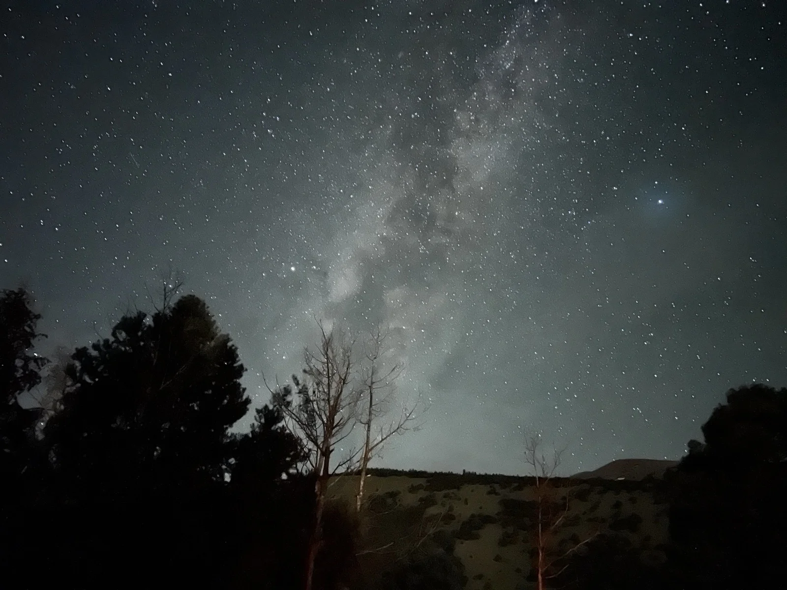
The Stars
Great Basin is one of the darkest places in the lower 48, and the reputation is earned. On both of my overnight trips, conditions were clear enough to sleep without the rainfly and fall asleep staring at the Milky Way. I shot a few photos with my iPhone that actually turned out, which tells you everything about how dark it gets out here.
Lehman Caves
If you have extra time in the park, Lehman Caves is worth a stop. You need to book tours in advance through Recreation.gov, and the 60-minute tours sell out fast.
On my most recent trip with my daughter, we grabbed a walk-up permit for the 30-minute tour at the Lehman Caves Visitor Center. There weren’t many left, and the 60-minute version was long gone from advance bookings. The cave features stalagmites, stalactites, flowstone, helictites, and shield formations. My daughter found it to be one of the more interesting experiences of the whole trip, and she’d just stood on a 13,000-foot summit that morning. Check walk-up availability at the visitor center, but don’t count on it for the longer tour. Book ahead if you can.
Gear You Actually Need
This isn’t a gear-intensive hike. The route is Class 1 with no technical terrain. But a few things matter:
Trekking poles. Not required on the way up, but they make the steep descent significantly easier on your knees. Bring them.
Water. 2-3 liters, carried from the trailhead. There’s no reliable water source on the route worth planning around.
Wind layer. Above treeline, wind is constant on most days. Even on warm summer mornings, the ridgeline and summit can be cold and exposed. A wind shell weighs nothing and changes the experience.
Sun protection. The entire upper route is above treeline with zero shade. Sunscreen, hat, sunglasses. Non-negotiable above 11,000 feet.
Layers for camping. If you’re staying at Wheeler Peak Campground at nearly 10,000 feet, nighttime temperatures drop fast. Even in August, bring warm layers for the evening.
The Case for Great Basin
Great Basin National Park is one of the least visited parks in the system, and it doesn’t deserve that distinction. The remoteness is part of the appeal. There’s no entrance fee. The campgrounds are first-come-first-served. The signature peak doesn’t require a permit or a lottery or a 6-month planning horizon. You just show up and hike.
In a world where every worthwhile summit seems to require a permit application, a lottery, and a backup plan, Wheeler Peak requires exactly none of that. 13,065 feet with 3,100 feet of gain, ancient bristlecone pines, one of the darkest skies in the country, and a campground at 10,000 feet that you can roll into without a reservation. That combination doesn’t exist anywhere else.
Chris has summited Wheeler Peak four times: August 2016 (solo), August 2017, August 2023, and June 2025. This article draws on all four trips.
Last verified: June 2026